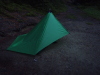
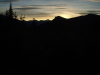
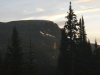
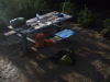
 |
 |
 |
 |
||
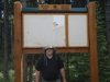
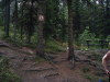
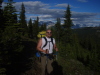
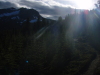
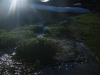
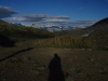
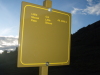
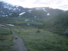
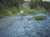
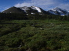
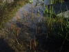
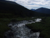
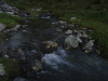
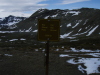
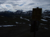
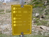
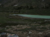
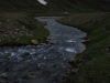
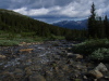
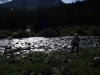
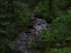
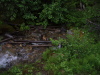
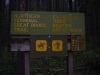
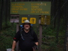
| New trailhead sign at northern trailhead | Jim at Evelyn Creek | Evelyn Creek |
 |
 |
 |
 |
||
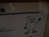
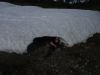
| This Black Dog was sent by my niece paige | So I would have an animal to sleep with |
 |
 |
 |
 |
||
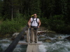
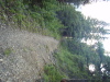
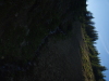
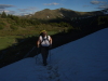
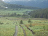
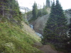
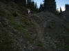
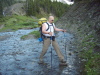
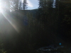
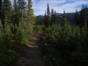
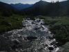
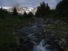
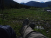
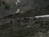
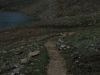
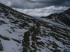
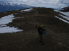
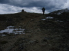
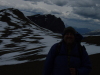
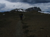
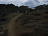
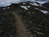
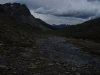
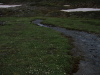
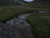
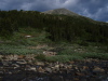
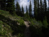
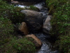
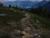
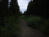
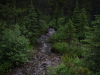
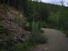
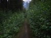
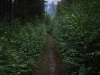
| Guarding my trekking pole | Trail climbing out of Evelyn creek |
 |
 |
 |
 |
||
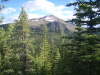
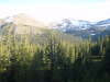
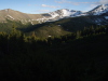
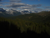
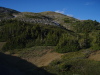
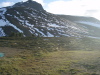
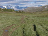
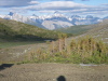
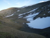
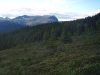
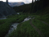
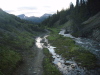
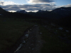
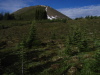
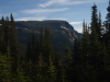
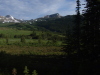
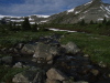
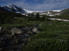
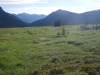
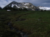
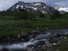
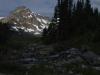
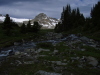
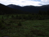
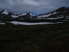
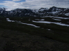
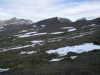
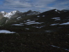
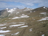
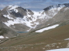
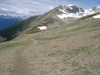
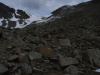
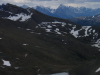
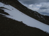
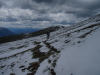
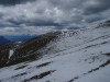
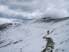
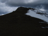
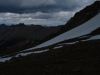
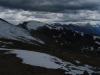
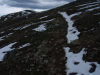
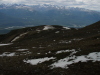
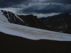
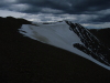
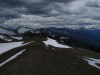
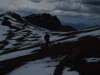
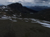
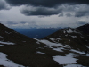
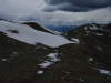
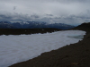
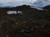
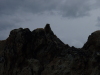
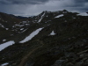
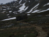
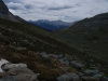
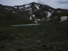
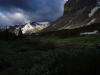
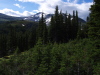
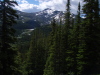
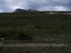
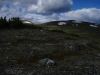
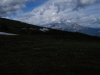
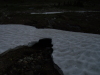
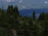
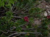
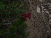
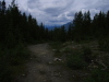
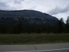
| The Bald Hills froom the trail. |
 |
 |
 |
 |
||
 |
 |
 |
 |
||
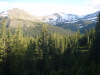
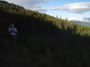
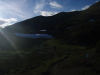
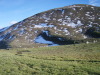
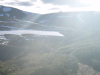
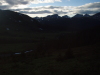
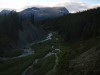
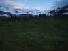
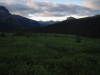
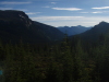
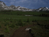
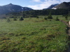
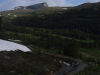
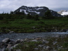
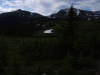
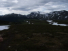
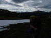
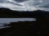
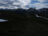
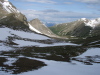
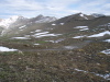
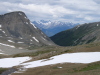
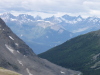
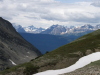
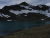
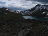
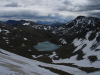
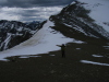
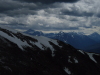
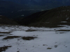
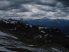
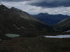
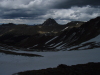
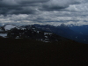
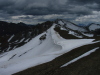
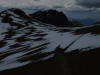
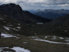
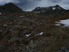
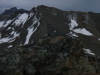
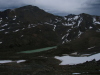
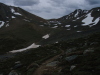
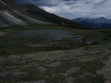
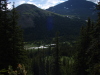
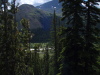
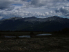
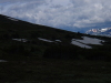
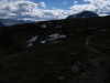
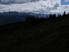
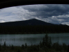
| Looking back toward Maligne Lake |
 |
 |
 |
 |
||
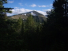
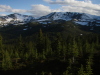
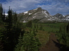
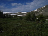
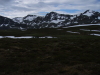
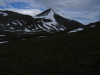
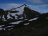
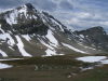
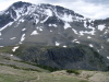
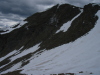
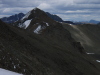
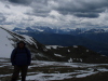
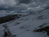
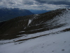
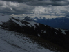
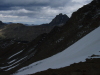
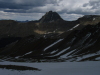
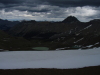
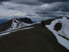
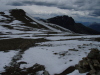
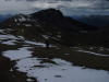
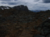
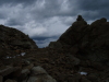
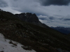
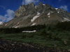
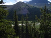
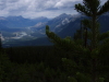
| Opal Peak on the left. |
 |
 |
 |
 |
||
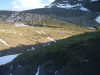
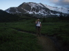
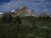
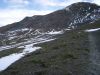
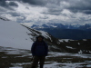
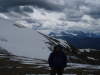
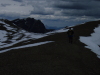
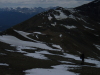
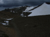
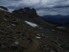
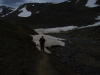
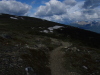
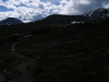
| Approaching Little Shovel Pass. | The bottom of Little Shovel pass with sun shining. | I head toward Little shovel with the sinking sun. |
 |
 |
 |
 |
||
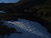
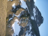
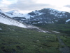
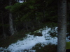
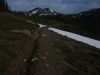
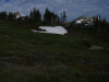
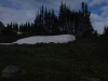
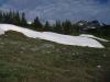
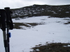
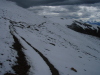
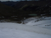
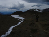
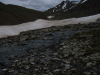
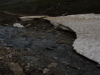
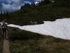
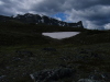
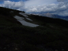
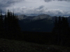
| Crossing the first of many drifts still left. |
 |
 |
 |
 |
||
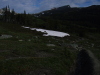
| Sun rays in Little Shovel Pass. |
 |
 |
 |
 |
||
 |
 |
 |
 |
||
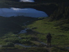
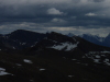
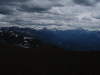
| last look back at the Maligne Lake area. |
 |
 |
 |
 |
||
 |
 |
 |
 |
||
 |
 |
 |
 |
||
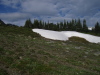
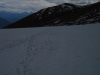
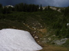
| Snowball tracks from recent blizzard. |
 |
 |
 |
 |
||
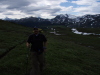
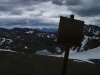
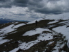
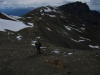
| Me at Little Shovel pass. |
 |
 |
 |
 |
||
| Descending into the Snow Bowl. |
 |
 |
 |
 |
||
 |
 |
 |
 |
||
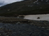
| Rock Hopping. |
 |
 |
 |
 |
||
 |
 |
 |
 |
||
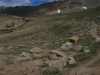
| Sun setting in snowbowl. | My hammock site in snowbowl campground. |
 |
 |
 |
 |
||
| Just before sunrise in snowbowl | Jim's new digs - SMD Lunar Solo | Morning was very frosty. Hard frost everywhere. |
 |
 |
 |
 |
||
| Sun slowly comes up behind mountains | Jim's brand new Caldera Cone. |
 |
 |
 |
 |
||
| Versus my old ratty Penny Stove. | View from the breakfast table in snowbowl CG | New skyline throne - these replaced old ones last year. |
 |
 |
 |
 |
||
| The sign and "Lumpy" are new this year. | View from the throne in snowbowl. |
 |
 |
 |
 |
||
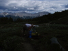
| Leaving snowbowl CG. |
 |
 |
 |
 |
||
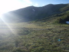
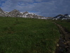
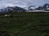
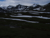
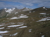
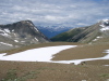
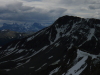
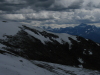
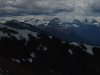
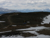
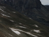
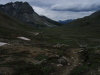
| Looking across the Snow Bowl towards big shovel pass on the right. |
 |
 |
 |
 |
||
 |
 |
 |
 |
||
 |
 |
 |
 |
||
 |
 |
 |
 |
||
 |
 |
 |
 |
||
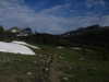
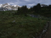
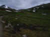
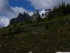
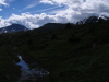
| Trail level view across snowbowl. |
 |
 |
 |
 |
||
 |
 |
 |
 |
||
 |
 |
 |
 |
||
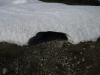
| Posing in melt cave. |
 |
 |
 |
 |
||
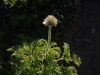
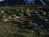
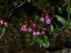
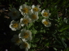
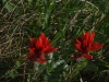
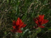
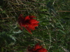
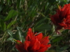
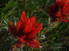
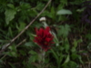
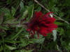
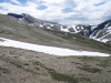
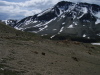
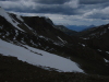
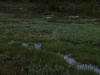
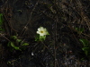
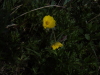
| We were too early for most of the flowers in snowbowl. |
 |
 |
 |
 |
||
 |
 |
 |
 |
||
 |
 |
 |
 |
||
 |
 |
 |
 |
||
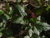
| Black dog checks out the flowers. |
 |
 |
 |
 |
||
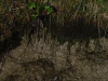
| Old grizzly track. |
 |
 |
 |
 |
||
 |
 |
 |
 |
||
 |
 |
 |
 |
||
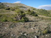
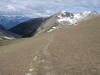
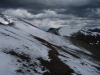
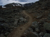
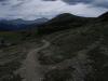
| The trail up to big shovel pass. |
 |
 |
 |
 |
||
 |
 |
 |
 |
||
| Big Shovel Pass | View of the notch from Big Shovel pass. |
 |
 |
 |
 |
||
| we're heading for that notch. |
 |
 |
 |
 |
||
 |
 |
 |
 |
||
| heading towards the notch and curator lake. |
 |
 |
 |
 |
||
| looking back at big shovel pass. |
 |
 |
 |
 |
||
| the start of the ascent to the notch. |
 |
 |
 |
 |
||
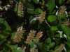
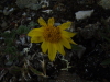
| Moss Campion. |
 |
 |
 |
 |
||
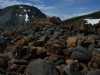
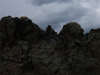
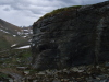
| The red rocks. |
 |
 |
 |
 |
||
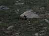
| Marmot | the trail heads past curator lake and up. |
 |
 |
 |
 |
||
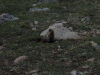
| Marmot posing. |
 |
 |
 |
 |
||
| Golden Mantle Squirrel | More squirrel.. |
 |
 |
 |
 |
||
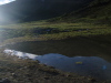
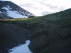
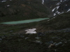
| little tarn, last water before climb - we filled up here. |
 |
 |
 |
 |
||
| Cornice on the notch. |
 |
 |
 |
 |
||
| Last bit of climb across snow. Too busy concentrating to take more pictures of this. | At the top of the notch, looking back over curator and big shovel | looking toward whistlers and jasper. | Athabasca valley from the notch. |
 |
 |
 |
 |
||
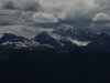
| Mt Edith Cavell from the notch. | Dont walk there. it's a long drop. |
 |
 |
 |
 |
||
| Cavell.. |
 |
 |
 |
 |
||
 |
 |
 |
 |
||
| looking back down to curator lake - you can see the trail. | Jim at the notch. | Me at the notch. |
 |
 |
 |
 |
||
| Me wandering around the notch saddle. | Time to find the warm stuff. it's cold up here. |
 |
 |
 |
 |
||
 |
 |
 |
 |
||
| starting out towards amber mountain from the notch. |
 |
 |
 |
 |
||
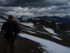
| hikers heading towards the notch. | skyline ambles across the mountaintops. |
 |
 |
 |
 |
||
 |
 |
 |
 |
||
 |
 |
 |
 |
||
 |
 |
 |
 |
||
 |
 |
 |
 |
||
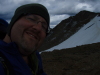
| Jim has the skyline grin - he hasn't hiked this before. |
 |
 |
 |
 |
||
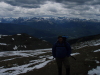
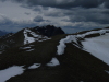
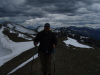
| Marmot basin ski area from the skyline. | Obligatory self photo. |
 |
 |
 |
 |
||
| The correct way to pee in 80km/hr winds is facing away from it. | The watchtower. |
 |
 |
 |
 |
||
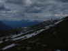
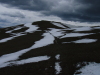
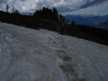
| skyline is a pretty nice ridgewalk. | Plenty of snow, even in july. |
 |
 |
 |
 |
||
 |
 |
 |
 |
||
 |
 |
 |
 |
||
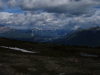
| Southward view from the top of skyline. |
 |
 |
 |
 |
||
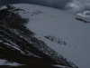
| little avy from recent blizzard. |
 |
 |
 |
 |
||
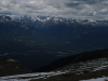
| Jasper townsite comes into view. |
 |
 |
 |
 |
||
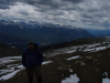
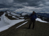
| Me at the apex of skyline on amber mountain. |
 |
 |
 |
 |
||
 |
 |
 |
 |
||
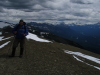
| Jim with Mount Tekkara | Me and Tekkara. |
 |
 |
 |
 |
||
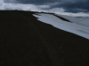
| more snow to cross heading down into the Tekkara basin |
 |
 |
 |
 |
||
 |
 |
 |
 |
||
| Switchbacks heading down into Tekkara basin. |
 |
 |
 |
 |
||
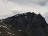
| Tekkara is imposing. |
 |
 |
 |
 |
||
 |
 |
 |
 |
||
 |
 |
 |
 |
||
| Dodging a huge drift to hit trail again, I did a small butt glissade at the bottom of that patch. | The descent into Tekkara. |
 |
 |
 |
 |
||
| Hello mister marmot. |
 |
 |
 |
 |
||
 |
 |
 |
 |
||
 |
 |
 |
 |
||
| The big glacial erratic on the way down. |
 |
 |
 |
 |
||
 |
 |
 |
 |
||
 |
 |
 |
 |
||
 |
 |
 |
 |
||
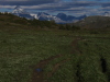
| trail descends through the alpine to tekkara. | Marmot butt. |
 |
 |
 |
 |
||
| mount Tekkara - approaching the campground. storms threaten. | Got my tarp up just as it started. Timing! |
 |
 |
 |
 |
||
| Sitting in my hammock watching the rain, and Jim's Lunar Solo. | A break in the rain, so out for dinner. |
 |
") |
 |
 |
||
| Morning view of Tekkara - note the typical sized mosquito landing on top. | Jim brought cereal, and shared, so I have a little Captain in me. (Crunch, not Morgan) | Sunny departure from tekkara campground. |
 |
 |
 |
 |
||
| tekkara CG bear pole |
 |
 |
 |
 |
||
 |
 |
 |
 |
||
 |
 |
 |
 |
||
| skyline heads around signal mountain. |
 |
 |
 |
 |
||
| Me, with the athabasca and yellowhead highway below. |
 |
 |
 |
 |
||
| The back side of Mount Tekkara from signal. |
 |
 |
 |
 |
||
 |
 |
 |
 |
||
 |
 |
 |
 |
||
 |
 |
 |
 |
||
 |
 |
 |
 |
||
 |
 |
 |
 |
||
| that little blob of buildings is the maligne canyon centre, near the trailhead. | Athabasca, and Highway 16 |
 |
 |
 |
 |
||
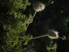
| Last year all the englemann spruce had cones - just remnants this year. |
 |
 |
 |
 |
||
| skyline sign at signal campground. | an old fire road descends from signal campground to the trailhead. |
 |
 |
 |
 |
||
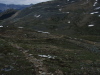
| the fire road is a trudge. | bear poop. there was about a pile per kilometer heading down from signal CG |
 |
 |
 |
 |
||
 |
 |
 |
 |
||
| plenty of elk poop as well. |
 |
 |
 |
 |
||
| Trailhead comes into view. | Great Divide Trail sign at the northern end of skyline. |
 |
 |
 |
 |
||
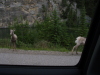
| Bighorns stopping tourons on the highway. | Medecine lake - heading back up to get my car. | Maligne lake lot, full of land yachts. |
 |
 |
 |
 |
||
| heading out, quick shot of maligne lake from bridge. | Tourons blocking the road for sheep. Grr. | Signal mountain and athabasca river from the road. |
 |
 |
 |
 |
||
| More sheep/touron traffic jams. |
 |
||
| Apres Hike supper at the L&W in Hinton. |